I wasn’t proposing to do a post before we headed off, however…..
See any patterns forming here ?
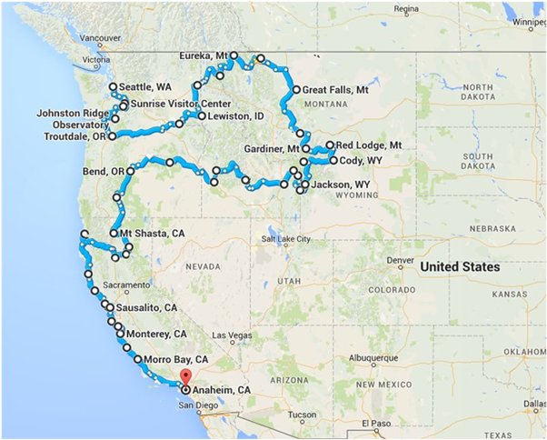
The map on the top shows our approximate route throughout our trip ………………

And this map is from Inciweb, the US Incident Information System, which compiles data on current conditions and events.
And yes, these are wildfires currently burning throughout the Pacific Northwest !
We have been monitoring a couple of them as there has been one in Glacier National Park which had the main road closed for a while and some accommodation – luckily not ours ! – evacuated and closed down for the rest of the season.
The other is in the northern parts of Crater Lake National Park which currently has the north entrance to the park closed – but hopefully only temporarily while they do back burning preparations.
It is a week or so before we get toward these parts so “fingers crossed” !
One thing is for sure – there will be some “hazy” backgrounds in our photos.
Ahhhhh the USA…… expect the unexpected !